Introduction to ProLinkAIM Property Details
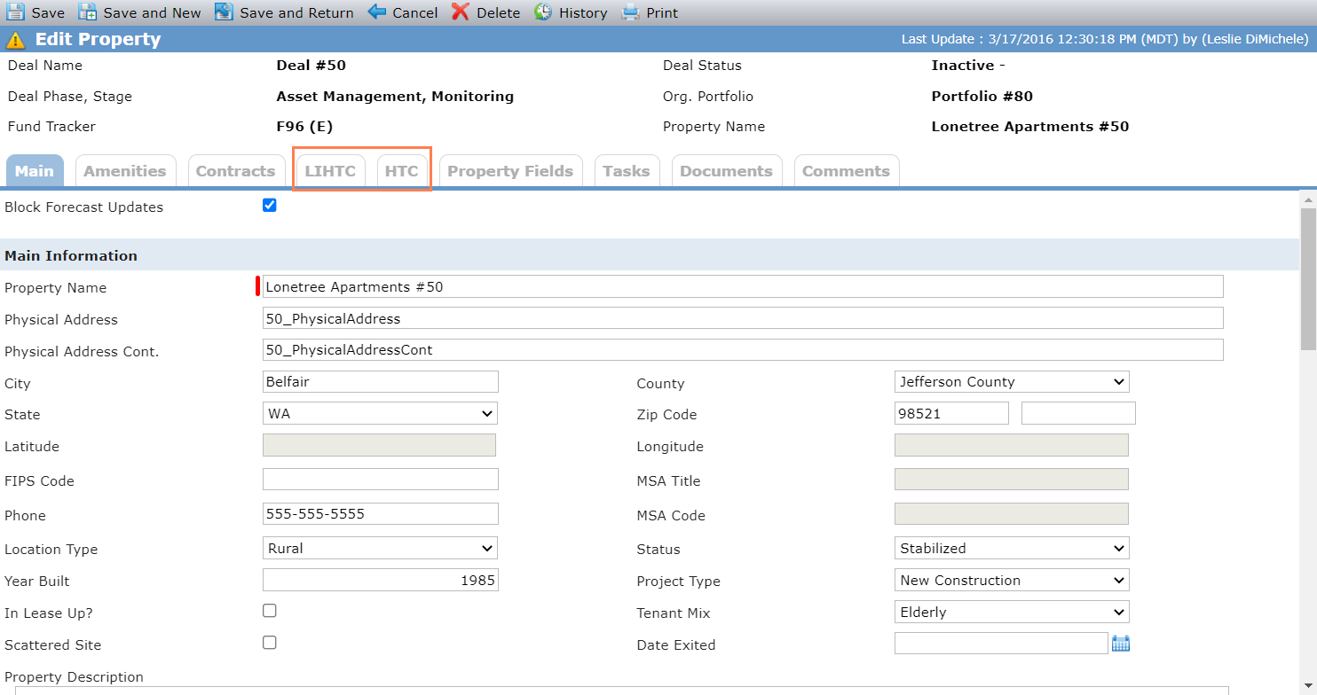
The Edit Property screen contains both high-level and detailed information regarding the properties on a deal. The information is spread across multiple tabs, some of which are displayed for deals with specific programs selected. The LIHTC tab is displayed only when the LIHTC program is selected, and the HTC tab is displayed only when HTC is selected as a program.
The Property data view, located under the Data View menu panel, allows users to view property-level data across deals. Additional property-related data views include the Subsidized Units and HUD 2530 Submission data views.
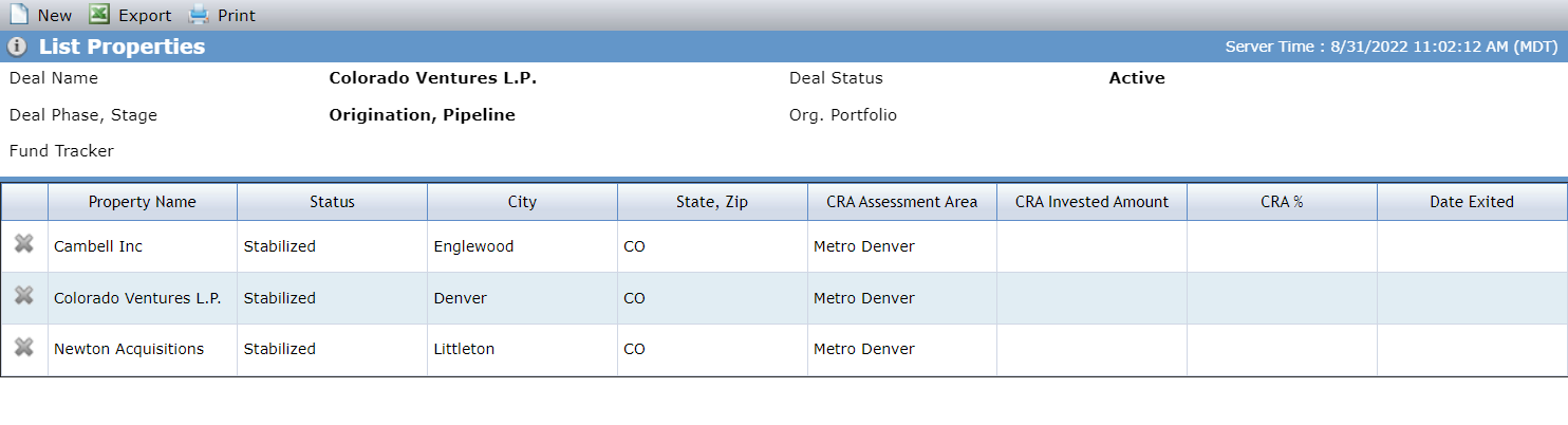
One Property record is systematically created when a new deal is added to ProLinkAIM. If additional properties are needed, you need to create them manually. From the Property Details screen, click Save and New to start a new property record. When a deal includes multiple properties, clicking the Property Details menu option opens a list screen, where you can select a specific property to view and edit its details.
Main Tab
Note
When the Block Forecast checkbox is selected, no update will be made through the SmartDox Financial Forecast schema. You might select this option if the Property record has been finalized and you don't want anything to be modified. Alternatively, if the Asset Manager is manually updating the record, this option would prevent the Underwriter from unintentionally overriding the information with his template.
The Main tab is broken into multiple sections, including:
Main—Contains location and general information.
Milestone—Contains projected and actual dates for tracking the progress of the deal through occupancy.
Property Profile—Contains unit information. Some of this information is specific to low-income deals. This section displays the breakdown of units and square feet for both tax credit and market units.
Note
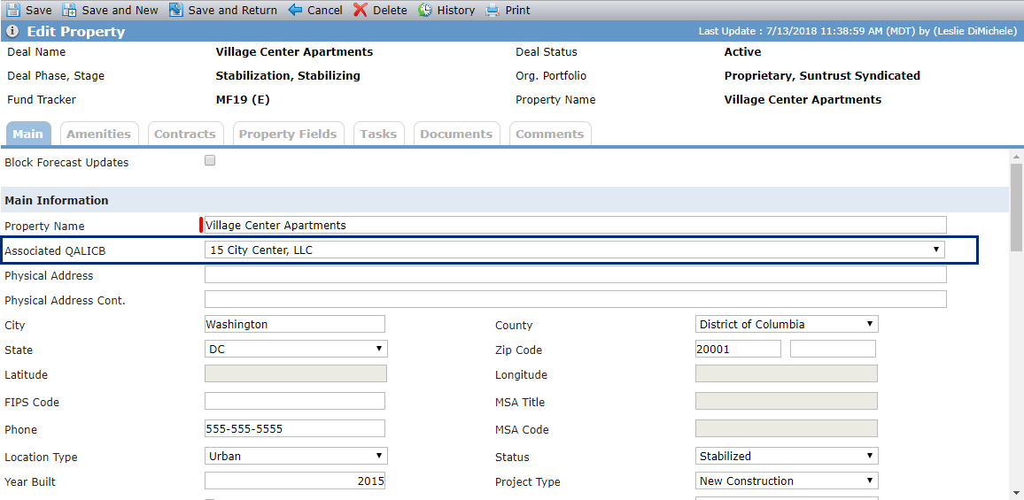
When NMTC is selected for a deal, the Associated QALICB field is displayed. This field is used to determine the Project Address of the QALICB for AMIS reporting.
Field | Description |
Property Type - Other | This field is displayed only when Other is selected as the Property Type value. |
Latitude | This value is populated from the Geocoding Service based upon the populated address. |
Longitude | This value is populated from the Geocoding Service based upon the populated address. |
MSA Title | This value is based upon the county selected for the property. If the MSA associated with the property has a Market Analysis record, the value is a hyperlink that displays the Market Analysis popup. If the MSA associated with the property does not have a Market Analysis record, the value is static text (no hyperlink). |
MSA Code | This value is based upon the county selected for the property. This value will not not be populated unless there is a corresponding MDA Admin record. |
Projected Lease Start Up Date | This value displays the first day of the earliest month for which Forecast Units are greater than zero on the Occupancy screen. |
Actual Lease Start Up Date | This value displays the first day of the earliest month for which 10 Yr TC Units are greater than zero on the Occupancy screen. |
Property Total TC Units | This value displays the sum of Property # of 10 YR TC Units + Property # of 15 YR TC Units. |
Property Total Units | This value displays the sum of Property Total Residential Units + Property # of Commercial Units. |
Total Residential Sq Ft | This value displays the sum of Tax Credit Sq Ft + Market Rate Sq Ft. |
Managers Unit Last Update | This value displays the date and time of the last update to the Property # of Manager Units field. |
CRA Assessment Area | This value is based upon the county selected for the property. This value will not be populated unless there is a corresponding CRA Admin record. |
Property Split Ratio | If the CRA Invested Amount is zero, the field displays 0%. The field displays 100% if the deal has a single property. If the deal has more than one property, the field displays the sum of all excluded properties on the deal with a non-zero invested amount divided by the property's CRA Invested Amount. |
Exclude from CRA | When the checkbox is cleared, the property is included in CRA reporting. When the checkbox is selected, the property is excluded from CRA reporting. See Investment Allocation Report 3.0 for information about CRA reporting. The Property - Exclude from CRA security privilege is required to select or clear the checkbox. |
Geocoding Latitude and Longitude
When a record is initially saved, if the Geocoding Service is on, the latitude and longitude will be updated based upon the Physical Address, City, State, and Zip Code of the property. The system administrator can manage the Geocoding Service through the Config Setting menu option under the ProLink Admin menu panel.
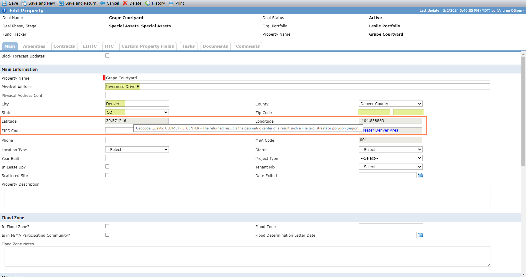
The system displays the latitude and longitude based on the most precise return location type (Rooftop, Range_Interpolated, Geometric_Center, or Approximate). The returned location types are defined by the Google Geocoding Service.
The Latitude and Longitude fields include a tooltip to indicate the return location type used:
Rooftop - The returned result reflects a precise geocode.
Range_Interpolated - The returned result reflects an approximation (usually on a road) interpolated between two precise points (such as intersections). Interpolated results are generally returned when rooftop geocodes are unavailable for a street address.
Geometric_Center - The returned result is the geometric center of a result such as a line (e.g., street) or polygon (region).
Approximate - The returned result is approximate.
Tip
In order for the geocode tooltip to be displayed or updated on screen, you must save the address entry and then reload the page.
MSA Market Analysis
If the MSA associated with the property has a Market Analysis record, the MSA Title field is a hyperlink. When you click the hyperlink, the MSA Market Analysis popup opens. The popup provides market information about the area where the property is located.
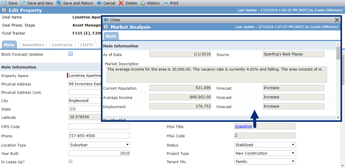
A property must first be associated with a Market Analysis to see market information for that property. To associate a market to a property, the county populated for the property must be included as a county in an MSA record. The system administrator can manage this information through the MSA Admin menu option under the ProLink Admin menu panel. Once the association is made, the MSA Title hyperlink will be displayed.